
Muhlenberg county was formed in 1799. It is located in the Western Coal Field region of the state. The elevation in the county ranges from 355 to 760 feet above sea level. In 2000 the county population was 31,839 in a land area of 474.7 square miles, an average of 67.1 people per square mile. The county seat is Greenville.

Butler county was formed in 1810. It is located in the Western Coal Field region of the state. The elevation in the county ranges from 385 to 810 feet above sea level. In 2000 the county population was 13,010 in a land area of 428.08 square miles, an average of 30.4 people per square mile. The county seat is Morgantown.
Mud River History (from various sources)
Frameless version of this page
Source: The Falls City Engineers: A history of the Louisville District, Corps of Engineers United States Army Page 49. Written by Leland R. Johnson, 1974. Published by United States Army Engineer District, Louisville, Kentucky.
Real-Time Data for Kentucky: Streamflow -- 179 site(s) found
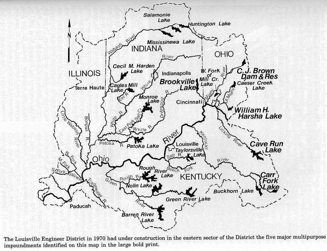
Green River Navigation
(from: The Falls City Engineers: A history of the Louisville District, Corps of Engineers United States Army 1970-1983)
"Like the Wabash, the Green River in western Kentucky had been navigated since pioneer days by a substantial flatboat traffic as far upstream as Greensburg and by steamboats to Mammoth Cave. To aid that commerce, state government during the 1830s built four locks and dams on the Green and one on its tributary Barren River to extend slackwater for commercial navigation as far as Bowling Green, Kentucky. The federal government purchased the state project in the late 19th century and the Engineers built Locks and Dams 5 and 6 on the Green River and another on the Rough River, a tributary, commercial navigation on the upper Green River ceased by 1951, and Locks 5 and 6 along with the Rough River Lock were closed.While shipment of coal from mines along the lower hundred miles of the Green began during the 1950s and the District built larger Locks at Dams 1 and 2 nearest the mouth of the river to serve that traffic, no substantial commerce upstream of Lock and Dam 3 developed, and when the 19th century stone and timbercrib dam at Lock 4 washed out on 24 May 1965, it was not repaired. The remaining stone and timbercrib dams on the Green River project were in such leaky condition by the 1960s that the District sometimes resorted to a 19th century technique for plugging the leaks to maintain pools by dropping hay and coal dust into the pools where the material would be drawn into the crevices in the dams, temporarily blocking the leakage. The timbercrib of Dam 1 [Green River] was removed in 1970 and replaced with a new dam built economically of the steel sheet-piling cells of the sort used for cofferdams on the Ohio River also for the temporary lockwalls constructed at Locks 52 and 53. When the contractor, Traylor Brothers, finished rebuilding Dam 1 for less than a million dollars in 1970, the tonnage moving on the Green River amounted to about eighteen million tons annually, chiefly coal bound for steam electric power plants along the Ohio River.
Public interest continued in restoring Green River Dam 4 and revitalizing navigation on the upper Green and also in a proposed high, multipurpose dam on the Green near Lock and Dam No. 3 at Rochester. The District Engineer advised the Governor of Kentucky in 1971, however, that there was little chance for the restoration of the old locks or for the modernization of facilities on the Green until coal or other commercial traffic began using the river upstream of Lock 3. On 21 November 1973, the District deactivated Lock 4 on the Green and Lock 1 on the Barren River, and "mothballed" the structures. The lockhouses and reservation at Lock 4 were deeded to Butler County which planned the development of a public park and local museum at the site.
When a towboat firm barged about 60,000 tons of coal through Green River Lock 3 at Rochester in 1976, indicating that shipments might continue, and while rumors circulated that grain and farm produce from along the upper Green might also start moving via the river, the District sent its repair station crew with the towboat Patoka up the Green in 1977 to repair Lock 3. The crew cleared the pool above Dam 3 and installed new lower gates in the lock, replacing the ancient manually operated capstans which had opened and closed the lock gates since the 1830s with an ingenious device allowing operation of the gates with a small electric drill working through a reduction gear. The change in gate operation ended an era, because Lock 3 was the last in the District and in in the United States to be operated by hand with the appliances that had been used at locks since their invention during the Renaissance in Europe.
Studies of a proposed high multipurpose dam at Rochester and of a dozen other plans for the future development, or non-development, of the Green River system were underway during most of the 1970s. The Barren River Area Development District, headed by Jack Eversole and with the support of local civic and business leaders, pressed the Corps for the construction of a new high dam or at least for restoration of commercial navigation facilities as far upriver as Bowling Green. They said the negative reports made by the District on the feasibility of modernizing the Green River had not adequately considered the potential for hydropower production and for industrial development which might result from modernization. "We tend to feel the Corps had prejudged the situation and are making their findings fit the plans," declared Jack Eversole, adding: "There are facts that the Corps ignores when making a study." Others apparently agreed with him, for when the District Engineer announced in 1979 that studies indicated neither the construction of a multipurpose project on the Green, nor restoration of the old locks and dams was economically justifiable. Congressman William H. Hatcher arranged for funding by Congress of a renewed study to be undertaken during the 1980s.
Two disputes concerning the Green River locks and dams made headlines during the early 1980s, one involving the proposed removal of Dam 6 and the other the closing of Lock 3. Environmentalists proposed the removal of Dam 6 to open the upper Green to canoeing and to lower the water level in the Mammoth Cave system which was thought to threaten with extinction the blind shrimp living in the cave system; other citizens feared removal of the dam might threaten local water supplies and curtail operations of the [Motor Vessel] (Mv) Miss Green River which carried tourist excursions along the river in the pool of Dam 6. While the District had expended large sums to maintain Dam 6, it did not object to its removal, for it had served no commercial navigation other than the excursion boat for years. The decision on the issue apparently hinged upon whether the U.S. Fish and Wildlife Service determined that the blind cave shrimp qualified as an endangered species.
Under pressure from Washington to reduce staffing and expenditures, the District proposed the closure of Lock 3 on the Green River, along with other antiquated locks on the Kentucky River upstream of Frankfort, in 1980. Only four barges passed through Lock 3 in 1980 and coal tonnage moving on the river downstream of Lock 3 was declining. "Right now there's a lot of pressure to reduce the number of federal employees," commented Larry Dickson, chief of the District's waterways management branch, adding that "once a lock or other facility doesn't support itself, it's hard to justify keeping it open.
The reaction of the citizens in the Green River valley was highly critical of the decision to close Lock 3. The editor of the Morgantown, Kentucky, newspaper declared that the "pencil-pushing public servants" at the Louisville District were wrong in thinking that the operation of navigation locks should be profitable, and local officials asked how they could develop traffic on the river if the locks were closed. Green River historian Helen Crocker urged that Lock 3 be preserved as a historic site, as an example of the ingenuity of the pioneer engineers who built and operated it without power equipment.
The Reagan administration insisted that personnel cuts at civil works projects be implemented, and on 1 October 1981, Green River Lock 3 ceased operation. It was placed in a caretaker status providing for periodic inspection and repairs necessary to maintain the pool. Rumor had it that a lockmaster still roamed the reservation of Lock 3 at night. The family of Lockmaster Randall Lytle, who were the last to live in the lockhouse at No. 3, were convinced the house was haunted, perhaps by the spirit of the old lockmaster. Mr. Lytle's children in fact had referred to the ghost as "Casper," after the cartoon character. Those who heard the story were amused by the thought of an apparition walking in circles at the capstans, opening the locks for diaphanous steam packets with excursion parties once again headed upriver to Mammoth Cave." Source: The Falls City Engineers: A history of the Louisville District, Corps of Engineers United States Army 1970-1983 Page 149-154. Written by Leland R. Johnson, 1984. Published by United States Army Engineer District, Louisville, Kentucky.
Early Navigation Projects on Green River, 1828-1842
(from: The Falls City Engineers: A history of the Louisville District, Corps of Engineers United States Army)
The first American pioneers to settle in the Green River Valley used the river and its tributaries to send produce in flatboats to New Orleans, but Evansville, Indiana on the Ohio just below the mouth of the Green, eventually became the marketing center for Green River commerce. During much of the nineteenth and for several decades in the twentieth century, the Green River Valley supplied Evansville saw mills and wood-working plants with timber; Evansville claimed in 1898 to be the largest hardwood manufacturing center in the world. Logs cut on the Green River or its tributaries in July were allowed to dry until winter, then pinned together with wooden pegs in rafts and floated down to Evansville.The steamboat McLean was the first to reach Bowling Green in 1828, and it was followed by other boats each high water. In 1828 also, Kentucky established a Board of Internal Improvements, which requested the loan of United States Army Engineers for surveys of streams in Kentucky. Lieutenant William Turnvull and Lieutenant Campbell Graham, Topographical Engineers, surveyed the Green River in 1828 and turned the results over to the state Board. As part of its state-wide internal improvements program, Kentucky authorized development of a slackwater project to improve navigation up the Green and Barren rivers to Bowling Green in 1833, and employed an experienced civil engineer, General Abner Lacock, former Congressman and Senator of Pennsylvania and engineer on the Pennsylvania canal system, to locate the locks and dams. The Green-Barren River project was the first improvement of its kind in the United States, and canal engineers were the men with the most closely related experience. (As previously mentioned, construction of a slackwater project became known as a "canalization" project; this is, to make like a canal.)
William B. Foster, also a Pennsylvania canal engineer, was first resident engineer in charge of construction, but because of ill-health he resigned in early 1835 and the project was completed under the direction of Alonzo Livermore, another Pennsylvania canal engineer recommended by General Abner Lacock. Construction of Locks and Dams Nos. 1 and 2 was underway when Livermore took over; however, Livermore modified their designs to increase lock chamber dimensions to 160 feet long by 36 feet wide. He selected sites of two more locks and dams on the Green (Nos. 3 and 4) and one on the Barren (No. 1) to establish 175 miles of six-foot slackwater navigation from the mouth of the Green up to Bowling Green on the Barren. The locks were constructed, under contract, of sandstone masonry laid in Louisville hydraulic cement (except No. 2 which was laid in common lime). To overcome a gradient of 78 feet in 175 miles, the locks averaged fifteen and a half feet of lift. The dams were timbercrib, rock-filled structures with masonry abutments.
Several contactors failed on the project, and other problems were experienced -- chiefly resulting from poor foundation conditions and damages to completed work by floods. A flood in 1840, for example, breached an abutment of Lock and Dam No. 3 and carried away the lower lock-gates. Exclusive of the costs of snag-removal and general channel clearance, initial construction costs aggregated $780,000 -- about $10,000 per foot of lock-lift. This cost was about triple the original cost estimates; however, the fist estimates were for smaller locks and lesser-quality materials and did not provide for such contingencies as the costs of repairing flood damages.
Though the project was not entirely completed in 1841, the steamboat Sandusky locked through to Bowling Green late in the year, thereby clearly demonstrating, one contemporary observer said, that "the removal of the obstructions to the navigation of all the great rivers of the West is practicable." Over $2,000 in tolls were collected during the first year of operation and fears that the project would form a health hazard and would be a waste of money were dissipated. Residents of the Green Valley readily acknowledged the "advantages derived from a perpetual line of the finest water navigation in the world." Regular steamboat trade between Evansville and Bowling Green was inaugurated; citizens of Bowling Green constructed a six-story warehouse at the river and a mule-powered railroad to connect the landing with the business section; and the project provided a substantial economic boost to the commercial development of the region.
Free Navigation on the Barren and Green, 1865-1890
The navigation structures on the Green and Barren rivers were damaged and their maintenance was neglected during the Civil War, and in 1868, rather than expend the funds necessary to repair the project, the state legislature leased the works to the Green and Barren River Navigation Company, an organization of bankers, attorneys, and steamboatmen led by W.S. Vanmeter, the steamboat captain who had obstructed Lock No. 3 for the Confederacy in 1862. The company operated the project, opened mines and entered other business, and ran its own steamboats, the Evansville and the Bowling Green. Since company-owned vessels paid no tolls, the company soon drove competition from the river and established a de facto monopoly.
Opposition to the monopoly soon developed, and it had very influential leadership in the person of General Don Carlos Buell, former Union General who settle in the Green Valley (at Airdrie, Muhlenberg County) after the war, opened coal mines, and began shipping coal down river to Memphis in late 1865. His business grew until 1868, when the navigation company took over the project and, with its toll-free privileges, undersold him and drove him from the market. General Buell lead a campaign to end the company monopoly and free the river of tolls. When his efforts failed in the state legislature, he took the case to Congress contending:
If the claim of Green River to the care of the Government as a public avenue rested on nothing but the expressive fact that at one period in our civil war the slackwater navigation served as a valuable channel of supplies for a Union army at a critical moment when all other lines failed, the question might properly be dismissed. But the ordinary trade of the Green River country has been relatively large from the earliest settlement, and the magnitude of its undeveloped resources especially in minerals, demands for it the facilities of an extended interstate commerce.
General Buell's complaint that the company rested "like an incubus on the destinies of the Green River Valley" brought Congressional action in 1879. An investigation ordered, and the Corps of Engineers reported that tolls on the Green and Barren rivers were excessive and that a monopoly did exist. Congress directed the Corps to ascertain the steps necessary for federal purchase and toll-free operation of the project, and a special Board of Engineers convened at Bowling Green in 1886. The Board conferred with directors of the company, inspected the project, reported that an injurious monopoly did exist, and recommended "in justice to the country tributary to the Green and Barren rivers, the present obstructive tax on its commerce should be removed." The Kentucky legislature ceded its rights to the project to the United States in 1886, and Congress purchased the company franchise for $135,000 in 1888.
Lock No. 3, the one most heavily damaged during the war, collapsed in 1887; other locks were in poor condition; the channel was littered with snags; and through navigation on the river had been suspended when the United States took over the project. Lieutenant William "Goliath" Sibert, Corps of Engineers, was assigned the duty of reopening the river to navigation. Sibert, a physically large man, had roomed at the Point with diminutive David Gaillard --hence Sibert's nickname "Goliath." His work on the Green and Barren river project was his first civil works experience and it launched him on a distinguished engineering career which took him around the world, but he was to call the Green River Country home ever afterwards. Sibert established an Engineer office at Bowling Green, arranged construction of the snag-boat William Preston Dixon to clear the Green River of snags, and initiated an emergency reconstruction of Lock No. 3 to reopen the river.
Difficulties were experienced in pumping water out of the cofferdam at Lock No. 3 in 1889, and in 1890 Lieutenant Sibert called in a waterways engineering expert, Benjamin F. Thomas, U.S. Assistant Engineer on the Big Sandy River, who got the cofferdam pumped out in ten days, put in the new masonry, and opened the lock to navigation on 10 November 1890. Residents of the Green Valley were "jubilant" and hundreds gathered at the river to see the first boat pass through toll-free. General Buell reopened his coal mines, the timber-rafting business increased, and, because the boats could transport commodities at about half the prevailing rail rates, railroads reduced rates to meet the competition. Commerce on the river quadrupled -- as many as sixteen steamboats soon plied the waterway regularly. The editor of the Calhoun, Kentucky, Constitution wrote in 1890:
It is very observable that since Green river has been made free to all who desire to run any kind of craft upon its waters, commercial affairs are assuming larger proportions; new farms are being opened, and various kinds of manufacturing establishments are springing up along its course.
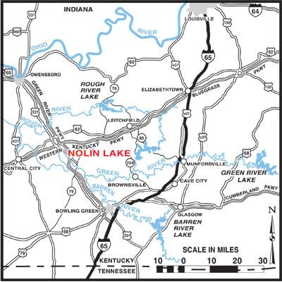
Rough River Project
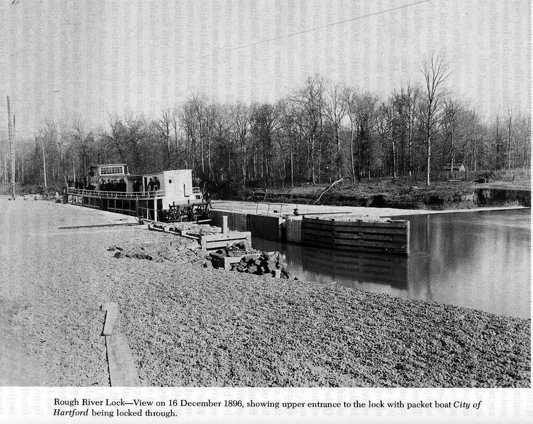
The success attending the repair and toll-free operation of the Green River project stimulated support for extending the slackwater system. Of special interest was the project constructed on the Rough River to furnish slackwater from the confluence of the Rough with the Green up to the town of Hartford, Kentucky -- it was the first river lock constructed entirely of monolithic concrete in the United States.
A Kentucky state engineer had surveyed the Rough River in 1836 and recommended a slackwater system for the stream to permit development of timber and mineral resources, but it was not done. In 1856 the Rough Creek Navigation and Manufacturing Company was incorporated, shortly after the Civil War it constructed a crude lock and dam about eight miles from the mouth of the Rough and a regular steamboat traffic developed up to Hartford. The trade ended, however, when the Green River Company abandoned its lock and dam.
Congress authorized a project to reestablish traffic on the Rough River in 1890. Trees were cleared from the banks, snags removed from the channel, and construction of a new lock and dam, near the site of the old one, commenced, under the direction of Assistant Engineer William M. Hall. Hall later directed the construction of sixteen locks and dams on the Upper Ohio River, and implemented a number of novel waterways engineering methods, such as those for anchoring concrete structures to foundation rock and for drilling cores from substrata to ascertain foundation conditions. Plans for the Rough River lock called for the use of common stone masonry in construction, but bids for furnishing cut-stone were excessive because of limited access to the project site, and Hall recommended the substitution of concrete of "imported Portland cement." The Chief of Engineers approved in 1895, and construction of the concrete lock, with chamber dimensions of 27 feet width, 123 feet length, and 9 feet lift, was completed in 1896, at a cost of $85,000.
Source: The Falls City Engineers: A history of the Louisville District, Corps of Engineers United States Army Page 146. Written by Leland R. Johnson, 1974. Published by United States Army Engineer District, Louisville, Kentucky.
In 1899, three steamboats and a number of small vessels were plying the Rough River to Hartford; they transported 10,883 tons of freight in that year. But 1899 was just about the peak for traffic on the Rough River. The project, except for its precedent-setting construction method, was a signal failure. No extensive traffic ever developed on the Rough River, though it is possible, because of how construction and operation costs, that during its many years of operation the public investment in the project was adequately reimbursed in the form of lower transportation costs, if reductions in rail rates are included.
Green River Slackwater Extension
When R.H. Fitzhugh, assistant to Colonel William E. Merrill, examined the Green River in 1879, he reported it would be feasible to construct eight locks and dams above Lock and Dam No. 4 (at Woodbury, Kentucky) on the Green River to extend slackwater navigation to such communities as Brownsville, Munfordsville, and Greensburg. Fitzhugh explored Mammoth Cave, reported that the water in the cave was the same level as the river, and concluded that a slackwater project would have no more effect on the famous cave than an ordinary rise in the river.
No action was taken on the Fitzhugh report, but concurrent with successful reopening of the old state project on the lower river, another examination of the Upper Green was authorized in 1890. Lieutenant William L. Sibert reported the construction of two additional locks and dams (Nos. 5 and 6) on the Green could open mineral and timber resources of such tributaries as Bear Creek and Nolin River to development and establish waterways transportation to the popular resort area at Mammoth Cave. Congress approved construction of Locks and Dams Nos. 5 and 6; William M. Hall moved Engineering equipment from Rough River and commenced construction; and in 1906 the steamboat Chaperon made the first run from Evansville to Mammoth Cave. A regular tourist and excursion traffic developed to and from the Cave region and commerce on the Green River system increased, but the public investment in Locks and Dams Nos. 5 and 6 was probably never reimbursed. Timber and asphalt resources on the Upper Green were developed to a limited extent, but general commerce was also served by the Louisville and Nashville Railroad and the turnpike between Bowling Green and Louisville. Source: The Falls City Engineers: A history of the Louisville District, Corps of Engineers United States Army Page 142-147. Written by Leland R. Johnson, 1974. Published by United States Army Engineer District, Louisville, Kentucky.

Governmental Links
Kentucky River Authority (for only Kentucky River)

Ohio River Navigation Information

Navigation Information Connection
(NIC)
Rough River Lake webpage with
USACE
Historical Links


County History EDMONSON COUNTY. The seventy-ninth county in order of formation, Edmonson County is located in south-central Kentucky. Bordered by Barren, Butler, Hart, Grayson, and Warren counties, it has an area of 302 square miles. On 12 January 1825, the county was formed out of portions of Hart, Grayson, and Warren counties and named in honor of Capt. John Edmonson of Virginia, who was killed at the Battle of the River Raisin during the War of 1812. BROWNSVILLE is the county seat.
With a gently rolling terrain giving way to pronounced hills in some sections, the topography is markedly diverse. Green River meanders from east to west; Nolin River flows primarily south, meeting the Green River just north of Brownsville. When the river was dammed in 1963, the 5,800-acre Nolin River Lake was created in the northeastern part of the county.
The most noted feature of the county is MAMMOTH CAVE, the largest cave system in the world; it is a 51,000-acre national park (much of it in the county). The landmark has ensured economic prosperity for the region. In 1988 tourism in Edmonson County accounted for more than $39 million in revenue and generated more than 1,400 jobs.
Edmonson, from its earliest days, has been largely agricultural. Evidence of habitation in the county by prehistoric Indians exists. White settlement came slowly, and in the 1830s, the county's population reached 2,642. Early pioneers came to the region to hunt, but the abundance of good pasture and farmland encouraged many to stay.
Being near the Confederate stronghold of Bowling Green, Edmonson County was the scene of several Civil War skirmishes. On 20 November 1861, a Confederate detachment from Bowling Green raided Brownsville to obtain medical supplies and engaged a Union regiment in a small-scale battle. In August 1862 the Federals avenged their earlier setback when a company of Home Guards defeated a Confederate guerrilla force east of Brownsville, taking seventy-seven prisoners.
Following the war, Edmonson County continued to prosper to a remarkable degree despite the lack of a major railroad or interstate highway service. In 1987 it ranked seventy-fourth among counties in agricultural receipts, mostly from livestock production. The garment industry also found a home in the county.
The population of Edmonson County was 8,751 in 1970; 9,962 in 1980; and 10,357 in 1990.
RON D. BRYANT
From The Kentucky Encyclopedia, edited by John Kleber. Copyright 1992. Reprinted with permission of The University Press of Kentucky.
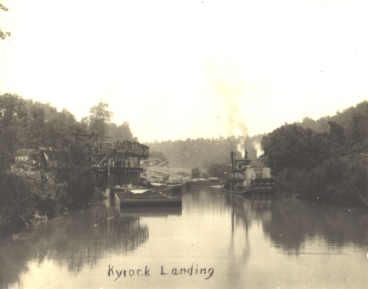
Steamer Emma was built in 1923
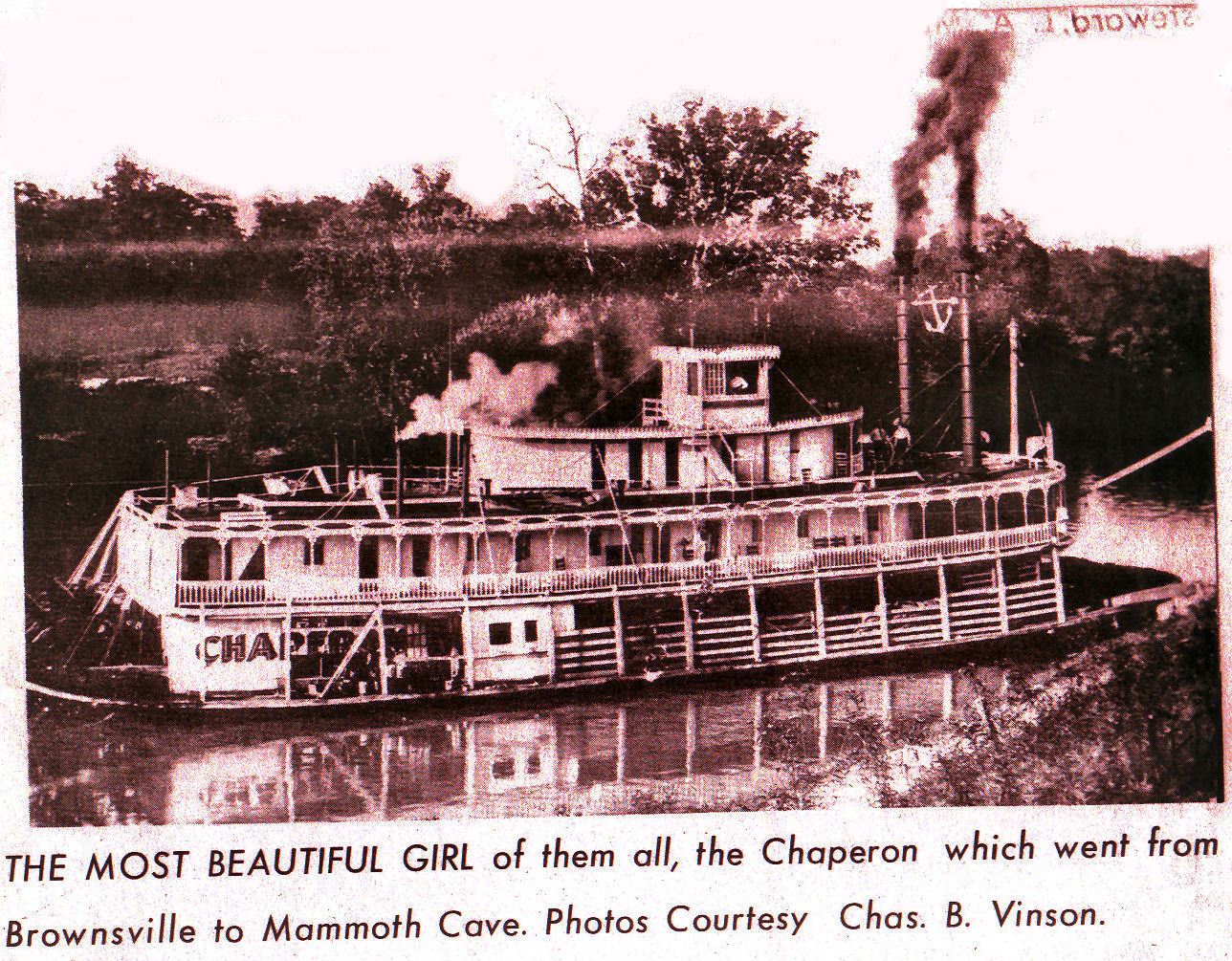
Steamer Chaperon
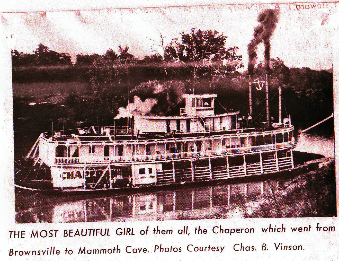
Steamer Chaperon
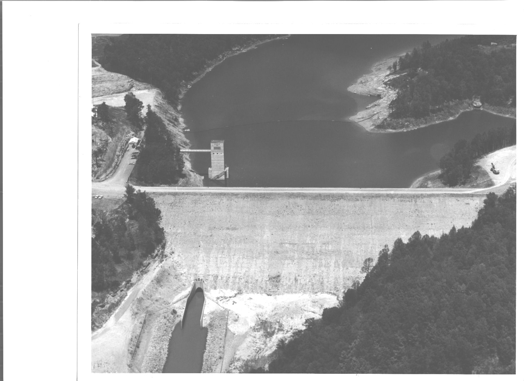
Nolin River Reservior Photo c735
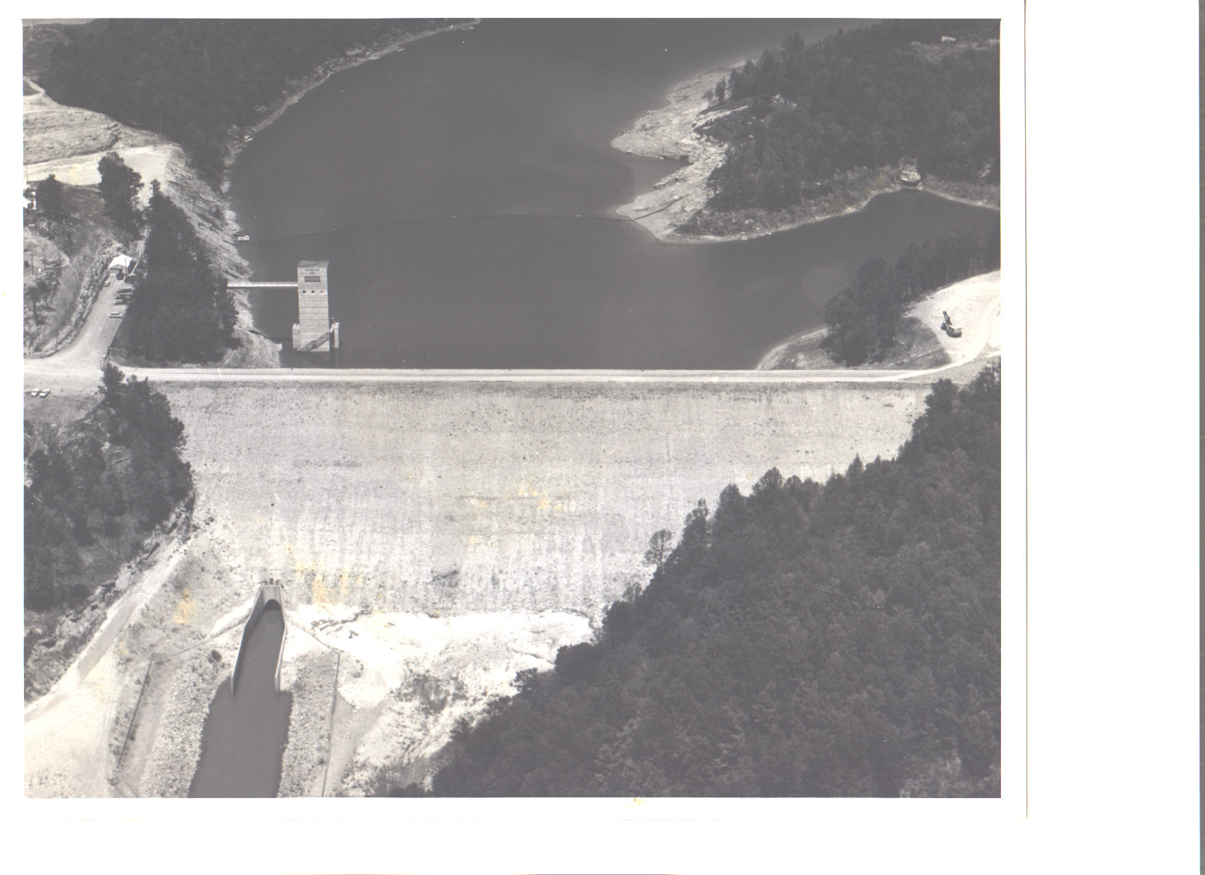
Nolin River Reservior Photo c735
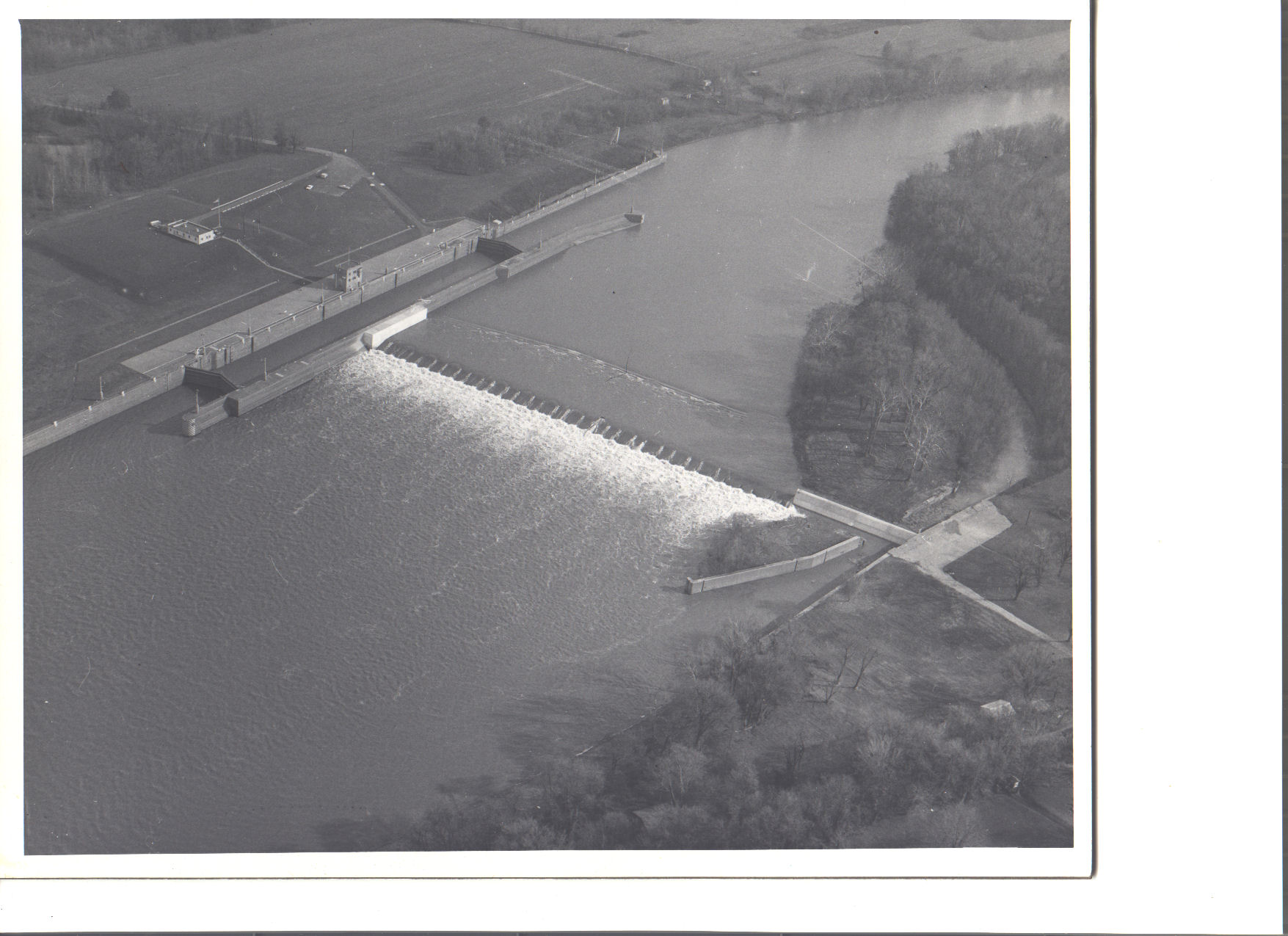
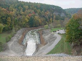
Green River Lock and Dam 1 Photo 3990 15 Dec 1970
Mammoth Cave National Park

This is the longest recorded cave system in the world with more than 336 miles explored and mapped. Photo caption: The Natural Entrance as seen from inside the Cave. (photo and text courtesy of the National Park Service)
Beneath the surface of south central Kentucky lies a world that is virtually unparalled. It is a labyrinth characterized by mile upon mile of dark, seemingly endless passageways. The geological process resulting in this world that we refer to as Mammoth Cave began hundreds of millions of years ago and continues today.
Mammoth Cave National Park was established to preserve the cave system, including Mammoth Cave, the scenic river valleys of the Green and Nolin rivers, and a section of south central Kentucky.
Mammoth Cave became a National Park on July 1, 1941 Mammoth Cave became a World Heritage Site on October 27, 1981 Mammoth Cave became an International Biosphere Reserve on September 26, 1990
EDMONSON COUNTY

Edmonson county was formed in 1826. It is located in the Pennyrile and Western Coal Field regions of the state. The elevation in the county ranges from 412 to 900 feet above sea level. In 2000 the county population was 11,644 in a land area of 302.62 square miles, an average of 38.5 people per square mile. The county seat is Brownsville. Most of Mammoth Cave National Park is within Edmonson county.
Brownsville, Kentucky
Brownsville, the seat of Edmonson county, is located on the Green River near the western edge of Mammoth Cave National Park. It was probably named for General Jacob Brown. The Brownsville post office opened in 1826. The population in 1990 was 897.
Mammoth Cave National Park
51,000 acres in Edmonson county.
Ohio County Map
Ohio county was formed in 1799. It is located in the Western Coal Field region of the state. The
elevation in the
county ranges from 365 to 800 feet above sea level. In 2000 the county population was 22,916 in a
land area of 593.79
square miles, an average of 38.6 people per square mile. The county seat is Hartford.
EDMONSON COUNTY
STEAMBOATING LINKS

More Steamboat Whistle Recordings


MEDIA LINKS

WEATHER DATA
The National Weather Service Wilmington River Forecast Center Home Page
NWS Wilmington RFC Hydrometerological Support Page
NCEP Hydrometerological Prediction Center Page
The latest images (and a good deal more) are available from The Daily Planet.
National Archives and Records Administration:
Records of the Office of the Chief of Engineers [OCE](Record Group 77)1789-1996:
77.10.26
Records of the Louisville, KY, District on Rough River
Textual Records (in Atlanta, except as noted): General records of the District Office, consisting of issuances, 1952-73; standard permit files, 1907-43; survey report files, 1931-74; engineering studies, 1837-1945; comprehensive reports and studies, 1911-55; basic topographical data, 1911-52; hydrological and hydraulic data, 1938-50; and records, 1940-51. Records of the Construction Division, consisting of civil works operations and maintenance files, 1873-1950; civil works construction files, 1936, 1939-52, 1958-70; and field notebooks, 1935-48. Daily vessel traffic logs for locks on the Green, Barren, and Rough Rivers, compiled by the Owensboro, KY, Engineer Office, 1896-1944 (in Chicago).
Maps and Charts: Reconnaissance of Ohio River above the falls, in album, 1819 (112 items). Ohio River survey atlas, 1914 and 1938 (560 items). Surveys and flood plain maps of the Ohio and Wabash Rivers, and other rivers in IN, IL, and KY, 1899- 1946 (340 items). Ohio River flood plain, Cannelton Pool Reach, KY and IN, 1965 (63 items). Rough River Reservoir, KY, 1941 (16 items). Property boundaries of Nolin Reservoir, KY, and Markland locks and dam, IN, 1960 (4 items). Savanna Army Depot, IL, 1986 (57 items). See Also 77.18.
Architectural and Engineering Plans: Locks and dams, and lock tenders' dwellings, on the Green and Barren Rivers, 1890-1952 (3,011 items). Plans from civil works project files of the Construction Division, 1958-70 (200 items, in Atlanta). Civil works project files, 1959-75. See Also 77.18.
Photographs (in Atlanta): District engineering activities and works, mainly on the Ohio and Kentucky Rivers, 1881-1962 (3,500 images). See Also 77.22.
6. Operation of Rough River Lock and Dam No. 1 near Hartford, Ky. has been discontinued.
River Charts
Ohio River and Green River Navigation Charts AvailabilityOhio River Navigation Charts
Louisville District Navigation Charts cover from Cairo, Ill. to Foster, Ky. (Charts 1-122). These charts include Louisville, Ky. and Cincinnati, Ohio. (Available for purchase from Government Printing Office or for download below.)Huntington District Navigation Charts
cover from Foster, Ky. to New Martinsville, W.Va. (Charts 122-186). (Available for purchase from Government Printing Office or possibly for download from the Huntington District website.)Pittsburg District Navigation Charts
cover from New Martinsville, W.Va. to Pittsburg, Penn. (Charts 187-224). (Available for purchase from Government Printing Office or possibly for download from the Pittsburgh District website.)Green River Navigation Charts
Green River Navigation Charts cover from confluence with the Ohio River to Lock and Dam 3 at Mile 108.5. (Available for download below.)Purchase Navigation Chartbooks
The 2003 Ohio River Navigation Charts are available for purchase from the U.S. Government Online Bookstore, or by calling the Government Printing Office toll-free at (866) 512-1800.Mail orders with an attached Government Printing Office order form are accepted. The Government Printing Office will accept payment by check, money order, Visa, MasterCard, Discover/NOVUS, American Express, or Superintendent of Documents Deposit Account. Navigation charts are no longer available for purchase directly from Corps of Engineers district offices. All hard copy charts must be ordered through the U.S. Government Online Bookstore.
Download Navigation Chartbooks
Navigation Charts for the Green River and the Ohio River (Louisville District) are available below in Portable Document Format (PDF). Use the Adobe Acrobat Reader or equivalent software to view them.18 NOV 2005 US Coast Guard contact information update
Green River: Charts 1 - 10 Updated 18 Nov 2005
Green River: Charts 11 - 20 Updated 18 Nov 2005
Green River: Charts 21 - 30 Updated 18 Nov 2005
Green River: Charts 31 - 40 Updated 18 Nov 2005
Green River: Charts 41 - 52 Updated 18 Nov 2005
Ohio River: Charts 1 - 5 (Cairo pool) Updated 18
Nov 2005
Ohio River: Charts 4 - 10 (Locks and Dam 53 pool)
Updated 18 Nov 2005
Ohio River: Charts 10 - 15 (Locks and Dam 52 pool)
Updated 18 Nov 2005
Ohio River: Charts 15 - 32 (Smithland pool)
Updated 18 Nov 2005
Ohio River: Charts 32 - 48 (John T Myers pool)
Updated 18 Nov 2005
Ohio River: Charts 48 - 60 (Newburgh pool) Updated
18 Nov 2005
Ohio River: Charts 60 - 85 (Cannelton pool) Updated
18 Nov 2005
Ohio River: Charts 85 - 102 (McAlpine pool) Updated
18 Nov 2005
Ohio River: Charts 102 - 122 (Markland pool)
Updated 18 Nov 2005
Ohio River: Lewis and Clark 2003 Commemorative Edition
pages
NAVIGATION NOTICE NO.
1-2004 Mississippi Valley Division Great Lakes and Ohio River Division Rev.97A January 2004
Ohio River Navigation Information
Index to Navigation Charts by
Corps District
Great Lakes and Ohio River Division
Maps
BOOKS ABOUT THE MUD RIVER


